Subsurface Utility Engineering (SUE) is a specialized branch of civil engineering that focuses on managing the risks associated with underground utilities. It involves the assessment, relocation, and design of utilities buried beneath the ground, such as pipelines, cables, and conduits. The scope of SUE encompasses various activities, including subsurface utility mapping, data collection, and communication of utility data to relevant stakeholders. By accurately locating and mapping underground utilities, SUE aims to prevent construction delays, accidents, and damage to existing infrastructure.
The role of subsurface utility mapping software in SUE
Subsurface utility locating and mapping software is a specialized tool designed to assist engineers and construction professionals in accurately mapping underground utilities. These software solutions utilize advanced technology, such as Geographic Information Systems (GIS) and Global Positioning Systems (GPS), to collect, record, and manage data on subsurface structures. With intuitive interfaces and user-friendly features, mapping software makes it easier for users to visualize and analyze underground utility data, ultimately improving the efficiency and accuracy of SUE projects.
Mapping software plays a critical role in SUE projects by streamlining the process of utility engineering mapping and data management. By digitizing and centralizing utility data, mapping software allows engineers to access and update information in real time, ensuring that project teams have the most up-to-date data at their fingertips. Additionally, mapping software facilitates collaboration among project stakeholders by enabling easy sharing and communication of utility data. This helps ensure that everyone involved in the project is on the same page and working towards a common goal.
Mapping software offers a range of features and functionalities tailored specifically to the needs of SUE projects. Some key features include:
- Data collection tools: Mapping software provides tools for collecting data on underground utilities using a variety of methods, such as GPS, electromagnetic induction, and ground-penetrating radar.
- Visualization tools: Mapping software allows users to visualize underground utility data in 2D and 3D formats, making it easier to identify potential conflicts and plan construction activities accordingly.
- Data management tools: Mapping software includes tools for organizing, categorizing, and storing utility data, ensuring that it remains organized and accessible throughout the project lifecycle.
- Reporting tools: Mapping software enables users to generate detailed reports and documentation on underground utility data, facilitating communication with project stakeholders and regulatory authorities.
Benefits of subsurface utility mapping software in SUE
Safety
Accurate underground utility mapping software enhances safety on construction sites by precisely identifying the location of buried utilities. This information helps construction crews avoid accidental utility strikes during excavation, reducing the risk of injuries to workers and damage to nearby infrastructure. By providing clear visibility into the underground environment, mapping software enables construction teams to plan and execute their activities with confidence, ensuring the safety of both workers and the public.
Accuracy
Subsurface utility mapping software offers unparalleled accuracy in locating and mapping underground utilities. By leveraging advanced technology and data collection methods, mapping software provides precise data that helps prevent errors and delays in construction projects. Accurate utility mapping enables construction teams to plan their activities more effectively, avoiding costly mistakes and ensuring the smooth progress of the project. Additionally, precise utility data allows engineers to design infrastructure with confidence, knowing that they have reliable information about the underground environment.
Cost savings
One of the most significant benefits of underground utility mapping software is its ability to save construction companies money by avoiding utility damage and relocations. By accurately identifying the location of buried utilities, mapping software helps prevent costly utility strikes and the need for expensive relocations. This not only saves money on repair and relocation costs but also minimizes project delays and disruptions, ultimately leading to greater cost savings for construction projects.
Legal protection
Accurate underground utility mapping software helps construction companies minimize legal liabilities associated with utility damages. By providing precise data on underground utilities, mapping software reduces the risk of accidental utility strikes and damage, mitigating the potential for costly legal disputes and breach-of-contract situations. By documenting utility locations and conditions, mapping software also provides construction companies with valuable evidence to defend against any claims of negligence or wrongdoing. Overall, mapping software offers construction companies greater legal protection and peace of mind when undertaking complex projects involving underground utilities.
How PointMan empowers Subsurface Utility Engineering
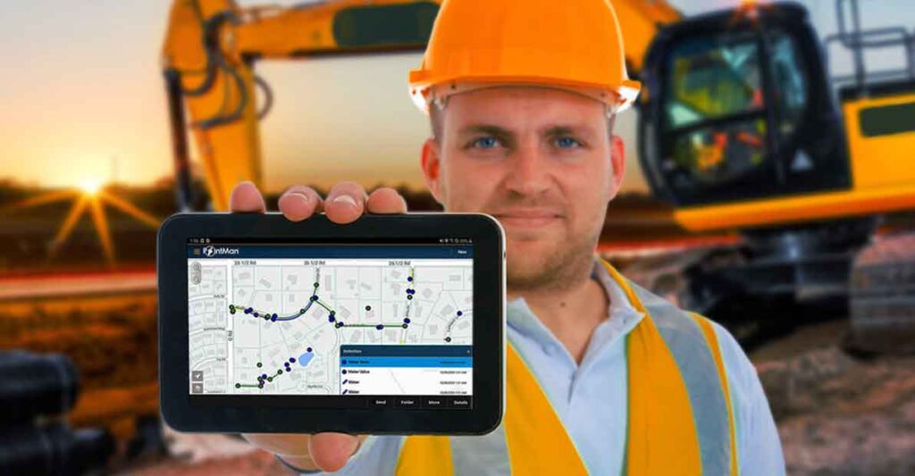
PointMan is a cutting-edge underground utility mapping software designed to empower Subsurface Utility Engineering mapping projects. It offers a comprehensive suite of tools and features specifically tailored to meet the needs of SUE professionals. With its intuitive interface and advanced capabilities, PointMan enables users to accurately locate, map, and manage underground utilities with ease.
Key features:
PointMan offers a range of key features and capabilities that make it an indispensable tool for SUE projects. These include:
- Advanced data collection tools: PointMan allows users to collect data on underground utilities using a variety of methods, including GPS, electromagnetic induction, and ground-penetrating radar.
- Real-time visualization: PointMan provides real-time visualization of underground utility data in both 2D and 3D formats, allowing users to easily identify potential conflicts and plan construction activities accordingly.
- Centralized data management: PointMan centralizes utility data, making it easy to organize, categorize, and access information throughout the project lifecycle.
- Collaborative workflow: PointMan enables seamless collaboration among project stakeholders, facilitating communication and decision-making.
- Customizable reporting: PointMan allows users to generate detailed reports and documentation on underground utility data, providing valuable insights for project planning and management.
PointMan stands out as the ideal solution for efficient utility surveys in SUE projects, offering advanced features and capabilities designed to empower SUE professionals. With its intuitive interface, real-time visualization, and collaborative workflow, PointMan enables users to streamline project workflows, enhance accuracy, and achieve better project outcomes. As a comprehensive and powerful underground utility mapping software, PointMan is the go-to solution for SUE professionals looking to optimize their utility surveys and ensure the success of their projects.
